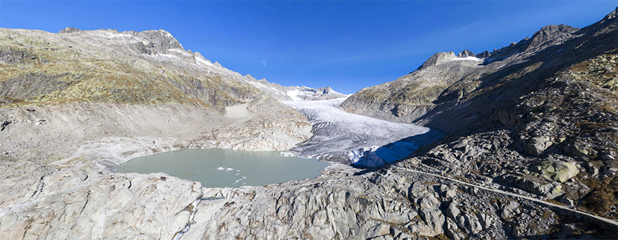
Fig.1 - Interactive 360° x 180° panorama of the Furka mountain pass near Belvédère, Switzerland (October 14, 2017).
The panorama was taken with a DJI Phantom 4 Pro quadrocopter and opens in new window. Java Script or HTML 5 is required. Used
software: PTGui (photo stitching software), krpano (viewer software), Adobe Photoshop. A large part of the sky is artificial
(the sky from an already existing image was added in Photoshop since the drone can't photograph straight upwards).